Insight
Choosing the Right Geotechnical Monitoring Solution
24 July 2024

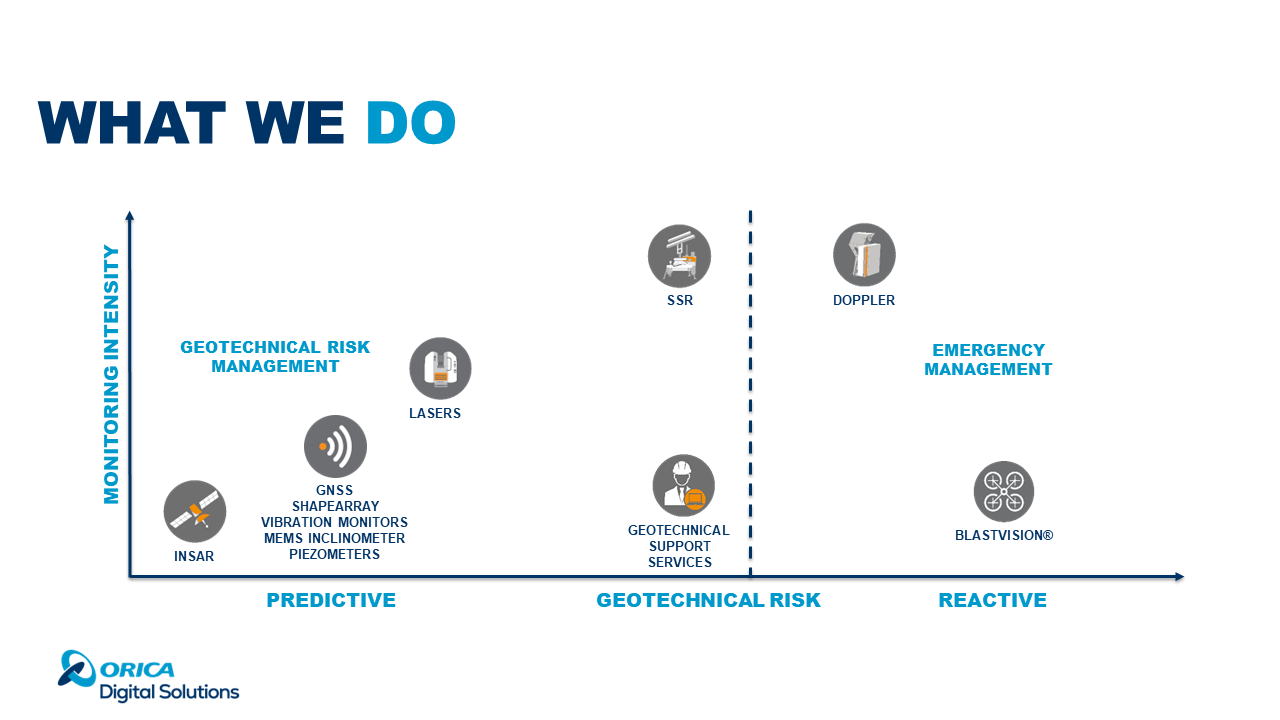
Geotechnical Risk Management
Monitoring in this phase aims to generate data, monitor trends, and understand the behaviour of the structure, also known as background monitoring. As movement and risk increase, the strategy shifts to safety-critical data supporting safety decisions, such as maintaining operations or evacuating the area. Key Tools:
- InSAR: Covers vast areas with precision and lower frequency of readings, identifying problems in their early stages and monitoring trends as risk increases.
- Local Sensors (GNSS, inclinometers, conventional geotechnical instrumentation): These are very precise and punctual but do not cover an area.
- Laser Solutions (Robotic Total Stations): Allows for the installation of a network of prisms to cover large areas, though data acquisition time can be sacrificed.
- Slope Stability Radars: Represent the pinnacle in terms of coverage, precision, data generation and safety critical solution.
Emergency Management
This phase is the last level of risk management when data indicates that a collapse is happening at that moment. These systems are designed for ultra-fast failures, such as dam failures, avalanches, and rock falls. It’s essential to remember that no monitoring solution provides all the answers. Choosing a solution is always a trade-off that may prioritize one parameter over another. — Antonio GroundProbe is a global technology leader specializing in real-time solutions for monitoring geotechnical risks. With the broadest range of technologies and services and a truly global support presence, we can offer a complete, customized solution for your needs. #GeotechnicalEngineering #RiskManagement #MonitoringSolutions #GroundProbe #SafetyFirst